
Need help submitting the form?
If you're facing any issues, our team is ready to help you directly via WhatsApp or Email.
The Nile stretches approximately 6,650 kilometres (4,130 miles) across northeastern Africa, making it the longest river in the world. It draws its waters from two distinct sources: the White Nile, which originates near Lake Victoria in Uganda and Tanzania, and the Blue Nile, which begins at Lake Tana in the highlands of Ethiopia. These two tributaries converge at Khartoum, Sudan, before continuing northward as a single river through Egypt and emptying into the Mediterranean Sea.
Within Egypt, the Nile travels approximately 1,545 kilometres from the southern border with Sudan to the Mediterranean coast in the north. Along this corridor, it carves through one of the driest landscapes on Earth — the Sahara Desert — creating a narrow strip of fertile land that stands in dramatic contrast to the endless sand and rock on either side. This strip, known as the Nile Valley, has an average width of only a few kilometres, yet it has supported human settlement continuously for more than five thousand years.
At its northern end, the river fans outward into the Nile Delta — a broad, triangular expanse of approximately 22,000 square kilometres where the river divides into multiple branches before reaching the Mediterranean Sea. The Delta is among the most fertile agricultural regions in the world and today supports a significant portion of Egypt's population of over 100 million people. For detailed geographic data on the river's course and hydrology, the United States Geological Survey (usgs.gov) and National Geographic (nationalgeographic.com) both maintain comprehensive resources.
No river in history has been more completely intertwined with the fate of a civilization than the Nile was with ancient Egypt. Greek historian Herodotus, writing around 450 BCE, famously described Egypt as "the gift of the Nile," and in every meaningful sense, he was right.
Ancient Egyptian civilization began to emerge along the river's banks around 3100 BCE, when the first pharaohs unified Upper and Lower Egypt — geographic divisions that corresponded directly to the upper and lower reaches of the Nile. For the next three thousand years, every aspect of Egyptian life, from food production and trade to religion, politics, and architecture, was organized around the river's natural rhythms.
The ancient Egyptians divided their world into two zones defined entirely by proximity to the river. Kemet, meaning "the Black Land," referred to the dark, silt-rich soil deposited along the riverbanks, the zone where crops grew, and life flourished. Deshret, "the Red Land," was the barren desert that began at the edge of the flood plain, a place associated with danger and death. This simple geography shaped an entire worldview: the Nile was the boundary between life and its absence, between civilization and chaos.
The ancient Egyptian calendar itself was built around the river, divided into three seasons: Akhet (the inundation), Peret (the growing season), and Shemu (the harvest). This cycle governed not only farming but taxation, religious festivals, royal ceremonies, and the administrative machinery of one of the ancient world's most sophisticated states. The British Museum's Egypt Collection (britishmuseum.org) holds one of the world's most significant archives of ancient Egyptian artefacts and offers extensive resources for those wishing to explore this history further.
The annual flooding of the Nile was the engine that powered ancient Egyptian civilization. Each year, floodwaters retreating from the banks left behind a layer of dark, mineral-rich silt that replenished the soil without any human intervention. Ancient Egyptian farmers cultivated wheat, barley, flax, papyrus, lentils, and vegetables in this naturally fertilized land, producing surpluses large enough to sustain a population that extended far beyond the fields themselves.
Those surpluses supported a complex, stratified society of priests, administrators, soldiers, craftsmen, and architects — none of whom grew their own food. It was the Nile's agricultural abundance, in other words, that made the pyramids possible. Without the flood, there was no surplus. Without the surplus, there was no civilization.
Egyptian farmers extended their reach beyond the natural flood zone using sophisticated irrigation systems — canals, basin flooding techniques, and shadoofs (counterweighted water-lifting devices) — that allowed them to cultivate land the floodwaters never directly reached. These systems supported a population estimated at three to five million people at the height of the New Kingdom period, a remarkable figure for the ancient world.
The Nile functioned as ancient Egypt's primary highway — a natural transport corridor that connected the country's northern and southern extremities with an efficiency that no land route could match. The river's current flows northward toward the Mediterranean, while the prevailing winds blow southward from the north. This natural arrangement allowed ancient Egyptian sailors to travel upstream with sails and drift downstream with the current, making the Nile an effectively bidirectional transport system.
Along this highway moved the materials of an empire: granite quarried at Aswan, gold from Nubia, cedar imported from Lebanon, luxury goods traded with the land of Punt, and the enormous stone blocks destined for the construction of temples and monuments. Archaeological evidence, including the discovery of ancient port facilities near the Giza plateau, confirms that the Nile was used to transport the stones of the pyramids themselves during the flood season, when elevated water levels allowed barges to navigate closer to the construction sites.
Trade networks extended through the Nile Valley deep into sub-Saharan Africa, across the Red Sea to the Arabian Peninsula, and throughout the Eastern Mediterranean world. The river was not merely Egypt's internal highway — it was its primary connection to the wider ancient world.
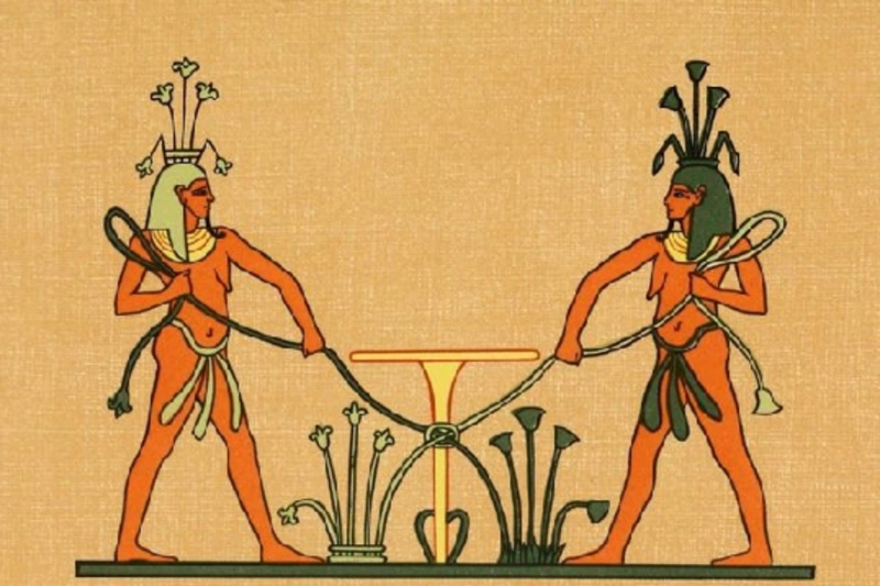
In ancient Egypt, the Nile was not simply a natural resource — it was a divine one. The annual flood, which arrived with the predictability of a calendar event and the abundance of a miracle, could only be explained, in the ancient mind, as the work of the gods.
Hapy, depicted as a robust blue or green figure laden with offerings of food and lotus flowers, was the god who personified the annual inundation. Worship of Hapy was widespread, and the failure of the flood to arrive at the expected time was interpreted as divine displeasure — a political as much as a religious crisis, since the pharaoh was responsible for maintaining the favour of the gods.
The Nile was also woven into the mythology surrounding Osiris, the god of death and resurrection, whose dismemberment and reconstitution by Isis mirrored the cycle of the flood — the land dying and being reborn each year. The sun god Ra was believed to sail through the underworld on a barque at night, emerging from the eastern horizon each morning in a journey that echoed the river's own northward flow toward the sea.
Major festivals tied to the Nile's seasonal cycle punctuated the Egyptian year, including Wepet Renpet — the New Year festival coinciding with the start of the inundation — which was celebrated with offerings, prayers, and public rejoicing. The Smithsonian Institution (smithsonianmag.com) offers extensive scholarly articles on the intersection of Egyptian religion and natural phenomena.
Control of the Nile's resources was inseparable from political authority in ancient Egypt. The pharaoh was understood to be the divine intermediary between the gods and the natural world, and a key measure of a pharaoh's legitimacy was the perceived health of the river during their reign. A good flood meant a blessed ruler. A failed flood meant questions were asked.
Egypt's administrative system — organized into regional divisions called nomes, each with its own governor — was structured primarily around the management and distribution of water. The state's capacity to collect grain taxes, maintain granary reserves, redistribute food during lean years, and mobilize enormous labour forces for construction projects all depended on the agricultural surplus generated by the river. The Nile was not merely a resource that Egypt used — it was the mechanism through which the Egyptian state itself functioned.
The monuments of ancient Egypt — the pyramids, the temples at Karnak and Luxor, the colossal statues and obelisks — are among the most enduring achievements in human history. All of them were made possible by the Nile.
Stone quarried at Aswan was loaded onto wooden barges and transported hundreds of kilometres northward during the flood season, when higher water levels allowed heavy cargo to be moved across terrain that would otherwise be impassable. Clay excavated from the riverbanks provided the raw material for mud bricks used in domestic and administrative construction. Papyrus harvested from the river's edges was processed into writing material that formed the administrative backbone of the state. Even the workforce that built the pyramids was fed from the agricultural surplus that the Nile made possible.
For further reading on ancient Egyptian architecture and its relationship to the river, Oxford Academic (academic.oup.com) and the UNESCO World Heritage documentation for Egypt (whc.unesco.org) both provide authoritative scholarly resources.
The Nile did not retire when ancient Egypt ended. The same river that sustained the pharaohs continues to define Egypt in the twenty-first century, in ways that are at once practical, cultural, and deeply symbolic.
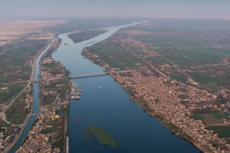
Approximately 95% of Egypt's population lives within a few kilometres of the Nile or within the Nile Delta a geographic pattern that has changed remarkably little since the time of the pharaohs. Cairo, the Arab world's largest city with a population exceeding 20 million, sits astride the river precisely where ancient settlements first took root thousands of years before it.
Agriculture along the Nile Valley remains vital to Egypt's economy, with crops including cotton, sugarcane, wheat, and rice still cultivated on the same land that fed ancient civilizations. The Nile also remains the country's primary source of fresh water, with Egypt receiving less than 20 millimetres of average annual rainfall across most of its territory — making the river not a convenience but an existential necessity.
Culturally, the Nile continues to occupy a central place in Egyptian identity, literature, music, and daily life. Riverside corniche promenades in cities like Luxor and Aswan are gathering places where locals and visitors coexist in the shade of the same landscape that ancient scribes once described in hieroglyphs. Traditional felucca sailboats still glide across the water at sunset, their triangular sails unchanged in shape for centuries.
For travellers, the Nile Valley remains one of the world's great journey experiences — a corridor of history unlike any other, where the distance between the present and the ancient past collapses to almost nothing.
The Nile is, and has always been, more than a river. It is the thread that runs through Egypt's entire story from the first farmers who watched the floodwaters rise, to the architects who floated stone across its surface, to the millions who drink from it today. Understanding the Nile is understanding Egypt itself.
The Nile River is the longest river in the world, stretching approximately 6,650 kilometres (4,130 miles) across northeastern Africa. It flows northward through ten countries, including Egypt, where it has sustained human civilization for over five thousand years. It remains the primary water source for Egypt and one of the most historically significant rivers on Earth.
The Nile River was the foundation of ancient Egyptian civilization. It provided fertile agricultural land through its annual flooding, served as the primary transportation route for trade and construction, inspired the core beliefs of Egyptian religion, and determined the structure of Egyptian politics and society. Without the Nile, ancient Egypt as a civilization could not have existed.
The Nile originates from two tributaries: the White Nile, which begins near Lake Victoria in Uganda and Tanzania, and the Blue Nile, which starts at Lake Tana in Ethiopia. The two join at Khartoum in Sudan and flow northward through Egypt, ending at the Mediterranean Sea via the Nile Delta in northern Egypt.
The annual Nile flood, known as Akhet, deposited rich black silt across farmland each year, naturally replenishing the soil with nutrients. This allowed ancient Egyptian farmers to grow abundant crops — including wheat, barley, and flax — without the need for fertilizers, creating the agricultural surplus that sustained a complex civilization of millions.
Within Egypt, the Nile stretches approximately 1,545 kilometres (960 miles), running from the Sudanese border in the south to the Mediterranean Sea in the north. It passes through major cities including Aswan, Luxor, Asyut, and Cairo before reaching the Delta.
The best Egypt luxury tour package — 5 nights Four Seasons Cairo + 4 nights DWA 5-star Nile cruise. All-inclusive & private. Send your inquiry today!

Our Egypt vacation package has everything: Pyramids, Nile Cruise, Valley of Kings & Sharm's beaches. Trusted by thousands. Request your free quote today!
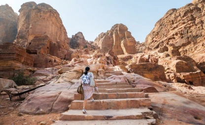
Discover the best of two legendary lands with the Pyramids, Abu Simbel, Nile Cruise & Jordan Tour. Explore Egypt’s timeless treasures—from the Pyramids of Giza and Valley of the Kings to a luxury Nile cruise—then cross into Jordan to uncover Petra, Jerash, and the Dead Sea. A seamless journey blending history, culture, and comfort.
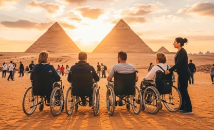
Explore Egypt’s ancient treasures on a wheelchair accessible cruise and disabled tour — designed for comfort and accessibility. Join us today!
If you're facing any issues, our team is ready to help you directly via WhatsApp or Email.

Copyright © 2026 Nile Cruise Vacation